


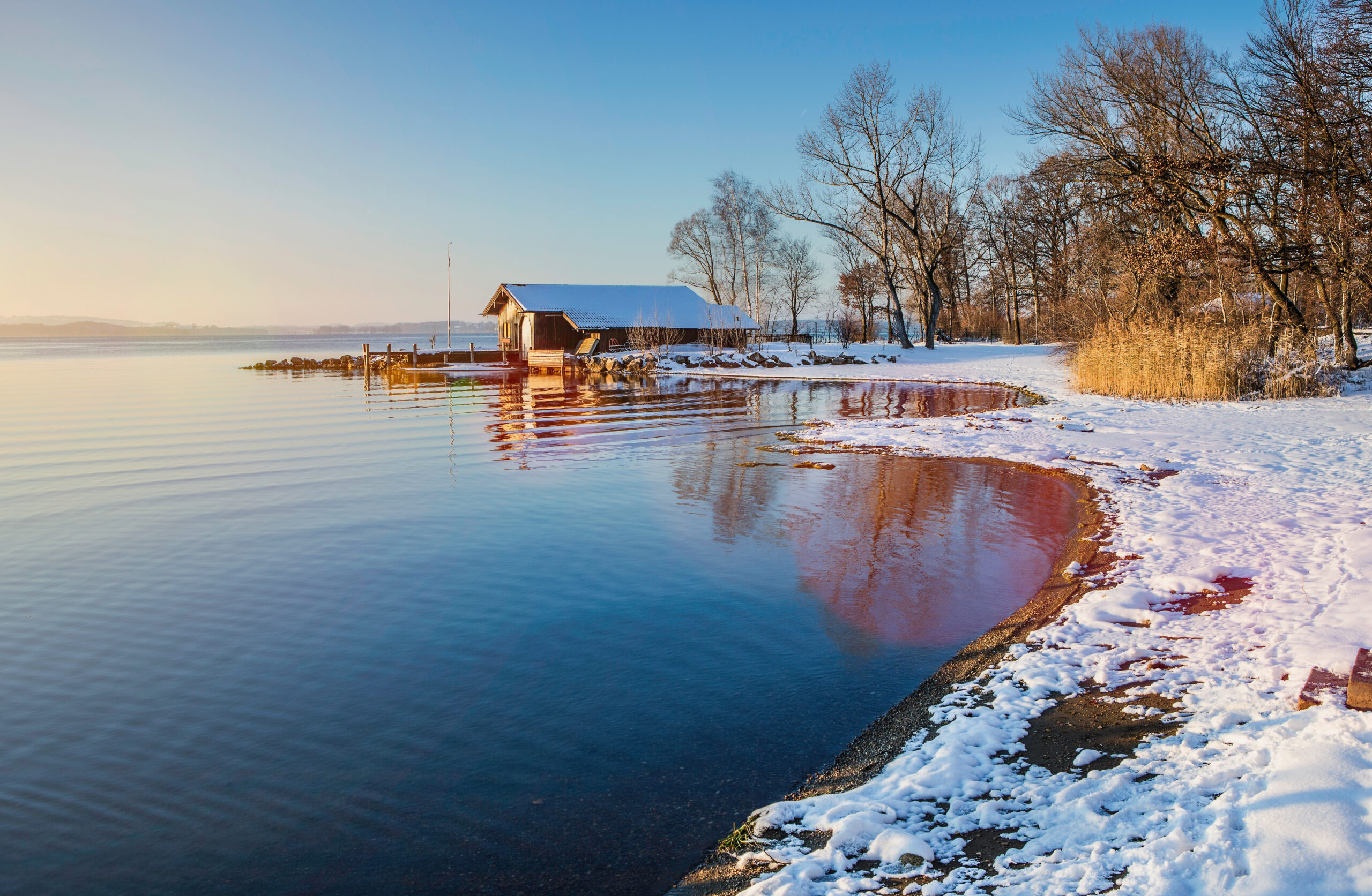
In Blekinge, southern Sweden, the average sea level is projected to rise 60 cm by the end of the century, with high tides, storms, and flash floods further compounding climate challenges and highlighting the urgent need for proactive interventions in the region.
With this in mind, the Region Blekinge and the Blekinge Institue of Technology (BTH) are working on innovative climate solutions that are being boosted by the RESIST project. One such example of climate innovation is the use of 14 extended reality (XR) demo sites throughout the region.
These demo sites combine Virtual Reality (VR), Augmented Reality (AR), Virtual Production, and AugmentCity’s Graphical Digital Twins (GDT) technology, and are aligned with participatory action research principles. They are designed to raise awareness and foster dialogue among citizens, policymakers, and planners to accelerate the implementation of climate adaptation strategies.
The demos have been showcased at the Pop-up Climate Tech Tour (PCTT), held three times in 2024–2025 with the attendance of around 210 participants, including politicians and decision-makers. The temporary and flexible format of the show allows rapid setup in different locations, making it well-suited to engaging local communities where adaptation projects are planned. By offering an immersive, interactive experience, the PCTT helps make complex climate issues more accessible and memorable.
Raising awareness on rising sea levels
The RESIST Project in Blekinge has developed immersive experiences on sea level rise and flooding, combining evidence-based content with interactive features that let users explore causes, impacts, and scientific context while actively manipulating scenarios.
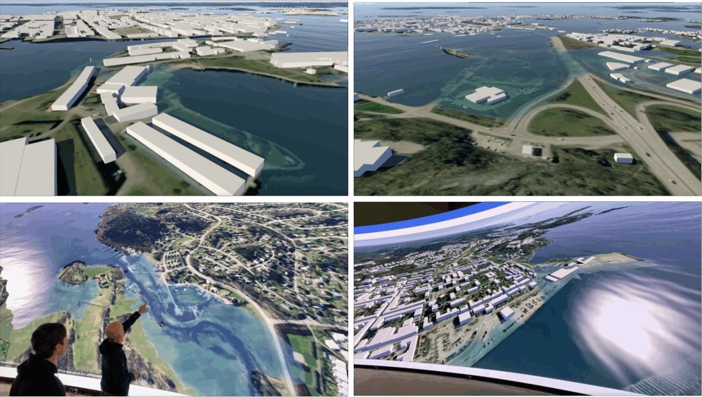
The AugmentCity Graphical Digital Twin (GDT) has been extensively applied and tested to illustrate the impacts of rising water levels and potential flooding in key areas of Blekinge.
This includes the neighbourhoods of Hattholmen and Stumholmen, as well as the surroundings of Nättrabyån in the city of Karlskrona. Additionally, the tool has been used to visualise flood scenarios along the Mieån river, which flows through the city centre of Karlshamn.
Recent work has leveraged advanced visualisation, rendering, and production pipelines to create highly interactive experiences. Enhanced graphics, realistic water and weather simulations, and scanned real-world elements immerse users in first-person explorations of climate and weather impacts.
A case study on Stumholmen Island in Karlskrona demonstrates how these tools allow users to engage, experiment, and reflect on climate change in a compelling, virtual production environment, fostering deeper understanding and a sense of urgency for adaptation
Gamification has been further combined with immersive visualisation, experiences captivate users through adrenaline-pumping moments that entertain while raising awareness by creating an immediate, in-game sense of urgency, making learning rooted and impactful.
A prime example is the VR demo ‘Escape the Water Rise,’ created by students under the RESIST researchers’ supervision using the Unreal Engine. In this immersive game, players must prevent the flooding of Karlskrona’s Naval Museum, projected for the year 2100. With just over a minute to activate water retention barriers, participants engage in a high-pressure, real-time simulation that not only heightens excitement but also offers a tangible, relatable way to understand the impact of climate adaptation in a familiar environment.
Flash flood awareness
Flash floods are another of the key challenges for the region of Blekinge. The local team has been exploring awareness raising on this issue through three interconnected XR demos, each focusing on different aspects of flood risk and visualisation.
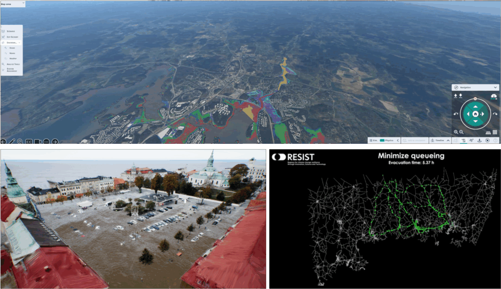
The GDT has been applied to visualise flood scenarios along the Lyckebyån River in Karlskrona, using data from the Swedish Civil Contingencies Agency (MSB) to provide colour-coded forecasts of water levels around the river’s outlet. To complement this, a highly realistic demo was created with drone-scanned point cloud data and Unreal Engine, showing the impact of a sudden cloudburst in Karlshamn’s main square.
This immersive model which has garnered media coverage from Sveriges Radio P4 Blekinge and SVT, raising understanding of the areas potentially affected by destructive flash floods. In addition, large-scale evacuation dynamics were explored through simulations in Karlskrona and Ronneby using the MATSim platform to model road networks and assess evacuation flows, offering valuable insights for emergency planning.
Drought and water scarcity
While Blekinge faces risks from rising sea levels and river flooding, the region is also increasingly vulnerable to drought and water scarcity. To raise awareness and explore potential solutions, two XR demos were developed focusing on water consumption and conservation. The first demo is an immersive VR tabletop experience for Sölvesborg, where colour-coded cubes represent households on a 3D map built in Unity with real consumption data and simulated forecasts, allowing users to explore present and future scenarios.
The second combines AR and gamification around a 3D-printed house model, guiding players through interactive prompts to learn about water use. Once completed, the visualisation shows both the household’s water sources and the city’s annual consumption, represented as a giant water cube placed in central Karlskrona to highlight the scale of demand.
XR for decision-making in climate adaptation
Beyond the XR demonstrators, RESIST partners in Blekinge are also working on a core project initiative: the XR Pathfinder. This initiative aims to lower the barriers to implementing and using XR technologies, enabling decision-makers and stakeholders to more easily engage citizens and co-design climate adaptation strategies.
Acting as a virtual assistant, it recommends suitable tools for both immediate needs and long-term planning, considering factors such as investment, usability, user engagement, maintenance and sustainability.
The guidance draws on lessons and best practices from RESIST, covering issues like costs, installation, data security and IT support. A first proof of concept is planned for October 2025. Complementing this, a set of demos various aspects of immersive XR functionality to support the design of large climate adaptation projects, aiming to inform decision-makers about solution requirements by tapping into the tacit knowledge of citizens and other stakeholders, both tangible and intangible.
Knowledge exchange within RESIST
Following the transfer methodology implemented within the RESIST Project, Blekinge has actively engaged in knowledge exchange within the project network. The region has adapted XR simulation methods and decision-support tools from Central Denmark, particularly in relation to flood modelling and stakeholder engagement. It has also shared immersive demo concepts with Central Denmark, Vesterålen, and Zemgale, including the use of digital twins and serious games to raise public awareness.
In addition, Blekinge has participated in mutual learning activities, demonstrating its XR applications and discussing implementation strategies with other regions. This collaborative approach has supported the alignment of adaptation strategies with best practices and fostered innovation across the RESIST consortium.
Learnings and next steps
Blekinge has gained valuable insights from using XR for stakeholder engagement. The region has found that XR is highly effective in making abstract climate risks tangible, particularly for non-expert audiences. Interactive experiences foster deeper engagement and can influence decision-making more effectively than traditional media, while co-creation with local stakeholders helps to ensure relevance and increase acceptance of proposed adaptation measures.
At the same time, several challenges have emerged, including the need to ensure accessibility and inclusivity for older populations or those less familiar with digital tools, balancing technical complexity with usability in public-facing demonstrations, and sustaining long-term engagement beyond the initial novelty.
Looking ahead, XR offers strong potential to support policy development, urban planning and education, as well as integrating real-time data from IoT sensors to enable dynamic scenario planning.
In parallel, Blekinge continues to develop its Smart Specialisation Strategy with climate adaptation as a central focus, in alignment with the EU Mission on Adaptation to Climate Change. The region is also expanding its quintuple-helix collaboration and is preparing to test XR tools in additional municipalities while further integrating them into planning processes. Committed to accelerating transformation and strengthening adaptive capacity through innovation and cross-border collaboration, Blekinge sees the use of digital twins and XR as a key decision-support tool.